
Showing posts with label Bridges. Show all posts
Showing posts with label Bridges. Show all posts
Monday, April 22, 2013
Baruch - Williamsburg North
Contrast of 50's era public housing to new luxury apartment towers. The public housing, just behind the Williamsburg Bridge approach road in the foregroud, is NYCHA's Baruch Houses, Lower East Side, Manhattan. The new towers in the distance are Northside Piers and The Edge, across the river in the northern end of Williamsburg, Brooklyn. The Williamsburg Bridge carries vehicular and subway traffic plus pedestrians and cyclists between the Lower East Side and Williamsburg.


Tuesday, April 16, 2013
TTW - Willy-B
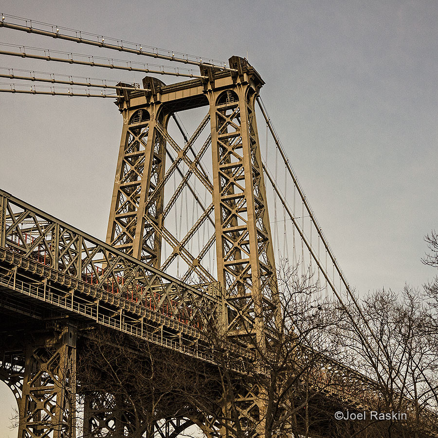
The Manhattan tower of the Williamsburg Bridge around sunset, taken thru a tinted taxi window. from FDR Drive at Delancey Street, Lower East Side, Manhattan

Friday, March 8, 2013
Manhattan Bridge Peek
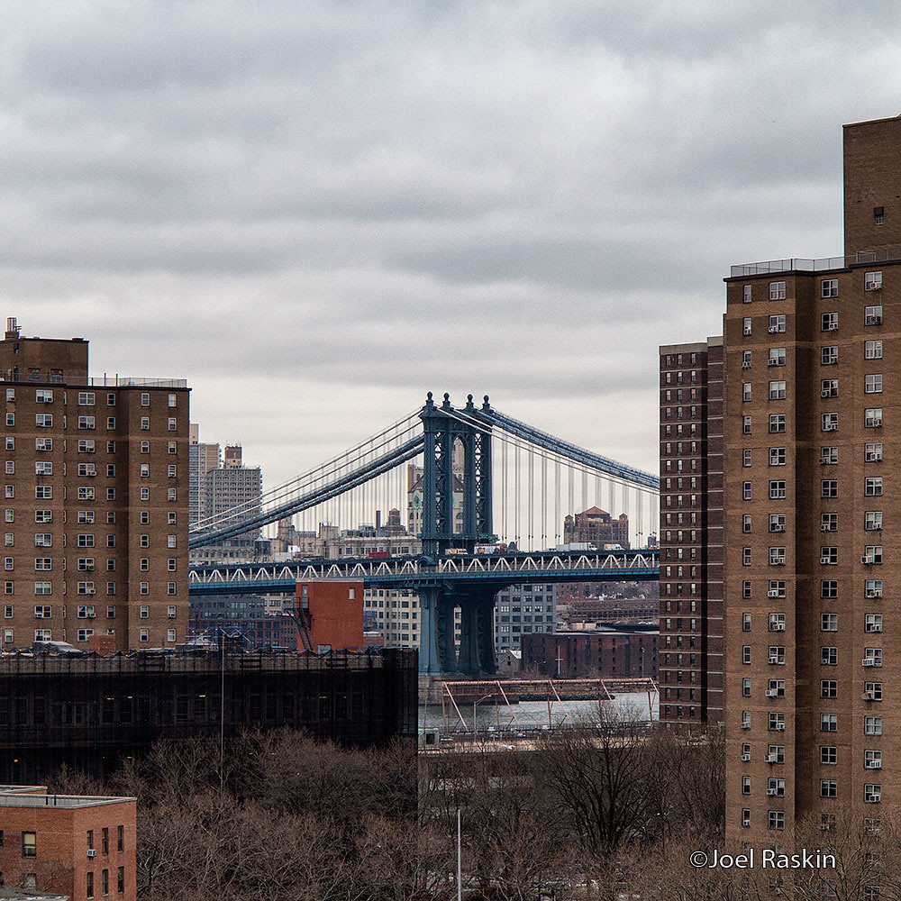
A peek at the Brooklyn end of the Manhattan Bridge between some Lower East Side apartment towers on a dreary, overcast day.

Tuesday, December 4, 2012
Williamsburg Bridge / Williamsburg Brooklyn
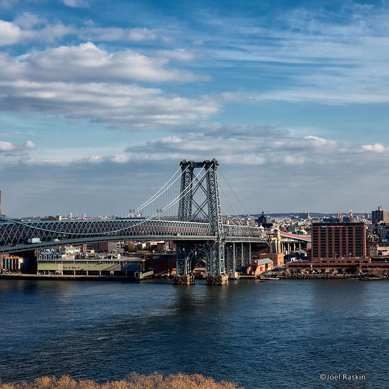
The Williamsburg Bridge, looking towards Williamsburg, Brooklyn. The bridge is one of my favorite subjects although not my favorite bridge. It's just down the block from here so it's a convenient subject and it's always there when I can't find anything else to take pics of

Friday, October 26, 2012
Lower East Side - Midtown View
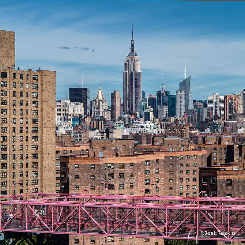
Looking north from Corlears Hook over Lower East Side NYCHA apartments (foreground) towards midtown Manhattan

Monday, October 22, 2012
Manhattan Bridge
Similar to a shot that I took a few years ago - this one in portrait orientation to capture more of the river below.This is taken from the Manhattan side of the Manhattan Bridge looking towards Brooklyn


Monday, September 24, 2012
Ed Koch - Queensboro Bridge
The Queensboro Bridge spans the East River connecting Manhattan and Queens, passing over Roosevelt Island. The bridge was recently renamed Ed Koch-Queensboro bridge (after former NYC mayor Ed Koch) and is also known as the 59th Street Bridge. Back in the 1960s Simon & Garfunkel's The 59th Street Bridge Song (Feelin' Groovy) brought some fame to the bridge. The Tram that runs alongside travels between Manhattan and Roosevelt Island.The tall green building seen under the bridge in the distance (lower right) is the Citicorp building in Long Island City, Queens.


Thursday, September 20, 2012
Low Tide - East River
At low tide there's a narrow sandy "beach" that appears under the Manhattan end of the Brooklyn Bridge. The horizontal shadow across the foreground is the Brooklyn Bridge above. While the public is not allowed access to this area I've often seen people climb the 3-ft barrier to dip their feet in the East River. At any time other than low tide this spot is completely under a few feet of water.
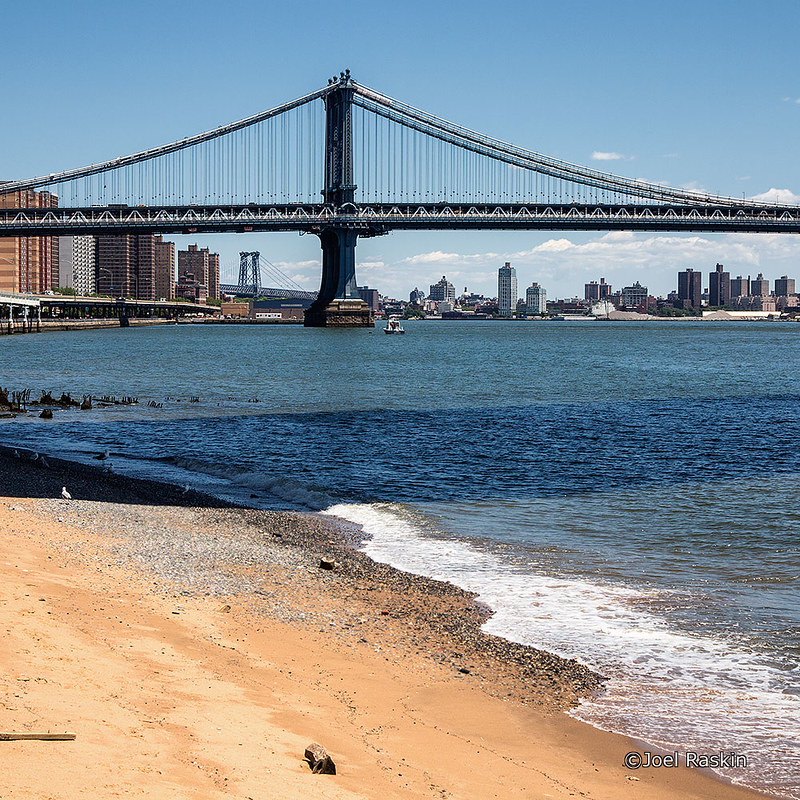
The bridge in the foreground is the Manhattan Bridge (looking at the Manhattan tower). Way off in the the distance (left) is the Brooklyn tower of the Williamsburg Bridge.

The bridge in the foreground is the Manhattan Bridge (looking at the Manhattan tower). Way off in the the distance (left) is the Brooklyn tower of the Williamsburg Bridge.
Wednesday, September 5, 2012
Skyline Wake
Sailing up the East River leaving the downtown Manhattan bridges and skyline in our wake. We call the East River a river but it's not really a river. It's a salt-water tidal strait that connects New York Bay with the Long Island Sound. Both the bay and sound open to the Atlantic Ocean.
The waters of the Atlantic Ocean, New York Bay, East River, and Long Island Sound completely surround the large body of land that Brooklyn, Queens, and "Long Island" sit on. So, technically, Brooklyn & Queens are on the same island as "Long Island." With Staten Island and Manhattan also being islands, this leaves The Bronx as the only part of NYC which is attached to the U.S. mainland.

The waters of the Atlantic Ocean, New York Bay, East River, and Long Island Sound completely surround the large body of land that Brooklyn, Queens, and "Long Island" sit on. So, technically, Brooklyn & Queens are on the same island as "Long Island." With Staten Island and Manhattan also being islands, this leaves The Bronx as the only part of NYC which is attached to the U.S. mainland.

Tuesday, August 21, 2012
River Traffic - Fulton Ferry
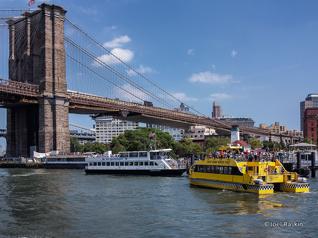
Fulton Ferry got its name from the ferry service between Brookyn & Manhattan started by Robrert Fulton in the early 1800s, long before the Brooklyn Bridge was built. At the time it was the only way to cross the river. By the early 1920s the Brooklyn Bridge had made ferry service obsolete and it was discontinued. But Fulton Ferry lived on as the name of this waterfront Brooklyn neighborhood. Today, ferry service is once again operating between Fulton Ferry and various other neighborhoods in Brooklyn, Queens and Manhattan.

Thursday, August 18, 2011
Under the Willy-B
Underneath the Williamsburg Bridge, taken from the Manhattan Side of the East River.


Wednesday, August 17, 2011
Old Railroad Bridge
I recently came across what remains of this old railroad bridge in the Hudson River at Riverside Park near W. 69th Street. The bridge was formerly a transfer bridge on the New York Central Railroad, allowing rail cars to transfer onto barges to cross the river. This site was added to the National Register of Historic Places in 2003.


Tuesday, August 9, 2011

Tuesday, August 2, 2011
Subway Tracks
Two views of of subway tracks from above. First: way below ground at 168th Street, Washington Heights, Manhattan (where you need to use an elevator to get to the platform). Second: high above the East River on the Williamsburg Bridge, between Manhattan and Brooklyn [click photo to enlarge]


Monday, August 1, 2011
East River - Downtown Skyline
A view of the East River from Corlears Hook to the downtown Manhattan skyline. The green area in the foreground is the southern end of East River Park at Corlears Hook, where the river makes an almost 90 degree turn. The building that looks like it has a rabbit ears antenna on top (far right skyline) is One World Trade Center (aka Freedom Tower) under construction.
[click photo to enlarge]

[click photo to enlarge]

Friday, July 22, 2011
New York Bay

Friday, July 1, 2011
Two Bridges
Manhattan Bridge (left) and Brooklyn Bridge (right) converging as they approach Brooklyn


Tuesday, May 31, 2011
Riding the Metro North Harlem Line
A couple of snaps from a moving train on the Metro North Harlem line - first is passing over E. 125th Street, 2nd is approaching the Harlem River looking towards the 138th Street Bridge.


Friday, May 20, 2011
Wise Guys Standing Guard
I rarely get to see the Williamsburg Bridge from this vantage point. In the foreground is upper half of Public School 110, with a bunch of wise old owls standing guard on its roof. Beyond is the Manhattan approach to the Williamsburg Bridge with it's elevated "hamster cage" pedestrian/bike path.


Tuesday, April 26, 2011
Williamsburg Bridge x2
Here are two photos of the Williamsburg Bridge (connecting Lower East Side, Manhattan with Williamsburg, Brooklyn) that I don't think I posted here yet. The first is from about 4 weeks ago on a day with unusually heavy cloud traffic. The second one is from about 6 weeks ago, taken around twilight from a higher/closer vantage point.


Subscribe to:
Posts (Atom)